


Fort Calhoun East Precinct, Washington County, Nebraska
About
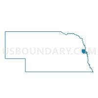
Outline

Summary
| Unique Area Identifier | 614004 |
| Name | Fort Calhoun East Precinct |
| County | Washington County |
| State | Nebraska |
| Area (square miles) | 22.54 |
| Land Area (square miles) | 21.65 |
| Water Area (square miles) | 0.90 |
| % of Land Area | 96.03 |
| % of Water Area | 3.97 |
| Latitude of the Internal Point | 41.43859390 |
| Longtitude of the Internal Point | -95.97535790 |
Maps


Graphs
Select a template below for downloading or customizing gragh for Fort Calhoun East Precinct, Washington County, Nebraska


Neighbors
Neighoring Voting District (by Name) Neighboring Voting District on the Map
- CRESCENT TWP Voting District, Pottawattamie County, IA
- Desoto Precinct, Washington County, NE
- Fort Calhoun West Precinct, Washington County, NE
- Northview Precinct, Washington County, NE
- Precinct 8-58, Douglas County, NE
- Precinct 8-59, Douglas County, NE
- Precinct 8-61, Douglas County, NE
- ROCKFORD TWP Voting District, Pottawattamie County, IA
Top 10 Neighboring County Subdivision (by Population) Neighboring County Subdivision on the Map
- Township 1, Washington County, NE (3,894)
- Florence precinct, Douglas County, NE (1,675)
- Crescent township, Pottawattamie County, IA (1,201)
- Rockford township, Pottawattamie County, IA (632)
Top 10 Neighboring Place (by Population) Neighboring Place on the Map
Top 10 Neighboring Unified School District (by Population) Neighboring Unified School District on the Map
- Omaha Public Schools, NE (346,311)
- Council Bluffs Community School District, IA (59,804)
- Missouri Valley Community School District, IA (5,332)
- Fort Calhoun Community Schools, NE (3,014)
Top 10 Neighboring State Legislative District Lower Chamber (by Population) Neighboring State Legislative District Lower Chamber on the Map
Top 10 Neighboring State Legislative District Upper Chamber (by Population) Neighboring State Legislative District Upper Chamber on the Map
- State Senate District 28, IA (56,661)
- State Senate District 18, NE (54,408)
- State Senate District 13, NE (36,243)
Top 10 Neighboring 111th Congressional District (by Population) Neighboring 111th Congressional District on the Map
- Congressional District 2, NE (638,871)
- Congressional District 1, NE (626,092)
- Congressional District 5, IA (577,453)
Top 10 Neighboring Census Tract (by Population) Neighboring Census Tract on the Map
- Census Tract 214, Pottawattamie County, IA (3,589)
- Census Tract 502.02, Washington County, NE (3,165)
- Census Tract 73.03, Douglas County, NE (2,834)
Top 10 Neighboring 5-Digit ZIP Code Tabulation Area (by Population) Neighboring 5-Digit ZIP Code Tabulation Area on the Map
- 68008, NE (12,285)
- 68112, NE (11,508)
- 68152, NE (5,837)
- 51555, IA (5,245)
- 68023, NE (2,536)
- 51526, IA (1,753)